AREAS OF SERVICE
The ARRO brand of civil engineering is rooted in our love of our profession, our dedication to our clients, and our desire to improve the environment and the communities we serve.
Geospatial/GIS
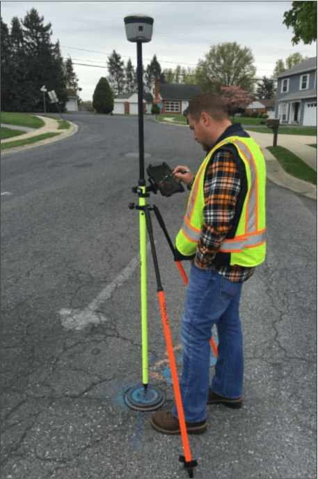
ARRO is a leader in Geographic Information Systems (GIS) technologies. For over 40 years, ARRO had provided state-of-the-art GIS solutions to diversified organizations of all shapes and sizes. Whether it’s implementing an automated data management system, creating a tool to model a utility network, or using cutting-edge data technology to locate features in the field, ARRO will provide a solution to fulfill your need.
ARRO provides state-of-the-art modeling for water, wastewater, and stormwater utilities. ARRO has the capability of identifying and solving complex issues such as water age areas of interest, contaminate mitigation, sanitary flow capacity analysis, stormwater flooding mitigation, and proper utility sizing.
Geospatial/GIS Services
capabilities
ARRO has the capability of identifying and solving complex issues such as:
- Water Age Areas of Interest
- Contaminate Mitigation
- Sanitary Flow Capacity Analysis
- Stormwater Flooding Areas
- Proper Utility Sizing
ARRO has the knowledge to assist organizations with developing desktop, online, and mobile applications specific to industry needs. Our team can provide you with digital mapping tools to visualize your data, create inspection and maintenance workflows and tracking systems to monitor progress, and implement notification systems and automated tools to help your organization run as efficiently as possible.
Mapping & Data Collection
- Utility System Mapping
- Historic Mapping
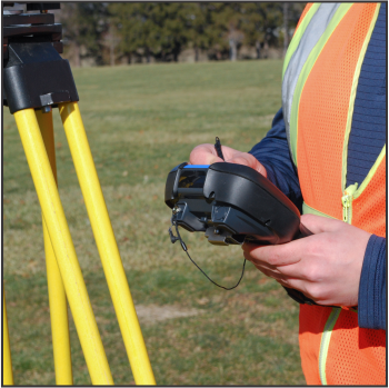
- Map & Survey Grade Data Collection
- MS4 Mapping, Planning & Analysis
- Zoning & Land Use Mapping
- Wetland & Water Resources
- Demographic Modeling
- Orthoimagery (Aerial Mapping)
- Elevation Modeling
- Public Data Collection
- Contaminant Source Inventory & Analysis
Data Management
- Process Automation
- Geodatabase Design and Management
- Document Scanning & Digital Integration
- Utility & Asset Management Tools
- Data Validation and Standardization
System Design/Implementation/Training
- Custom Application Development
- Asset Tracking, & Reporting Solutions
- Integrating and Simplifying Solutions
- Data Accessibility
- Local & Cloud Data Management Solutions
- Support, Training, & Updates
Custom Tool Development
- Desktop, Cloud, & Mobile Solutions
- Municipal Asset Tracking and Reporting Tools
- Digital Workflow Automation
- Automated Document Production
- Public/Private Notification and Reporting Systems
- Form Digitization
- Map Based Web Portals
- Site Modeling
- Real Time Data Monitoring
- SCADA Integration

FEATURED PROJECTS
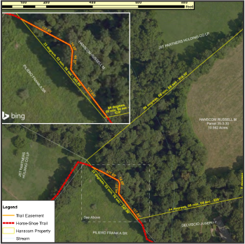
Horse-Shoe Trail Conservancy GIS
The Horse-Shoe Trail Conservancy is a non-profit organization that has stewardship over a 140-mile-long trial that runs from The Appalachian Trail in Dauphin County to Valley Forge National Park.
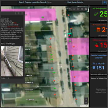
Learn More Borough of Spring Grove Code Enforcement System
The Borough of Spring Grove Borough in York County, PA wanted to streamline Borough code enforcement without having to invest in another expensive piece of software with additional annual licensing costs. ARRO was able to leverage the Borough’s existing ArcGIS account to build a sophisticated, automated,...
Learn More Ephrata Area Joint Authority GIS Consultation Services
ARRO was contracted to provide GIS consultation to manage the geospatial data for the Authority’s fire hydrants, water main valves, fire hydrant valves, abandoned mains, curb stops and blow offs.
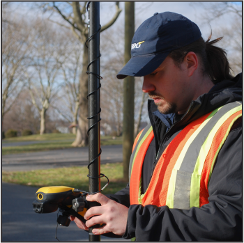
Learn More Myersville MS4 Stormsewer GPS
ARRO was contracted by the Town of Myersville, Maryland to do an onsite acquisition of GPS data and attributes of municipal, private, and MDOT storm sewer assets to complete and add attribute data to the municipality’s aging storm sewer map.
Learn More
The Horse-Shoe Trail Conservancy is a non-profit organization that has stewardship over a 140-mile-long trial that runs from The Appalachian Trail in Dauphin County to Valley Forge National Park.
Read More
The Borough of Spring Grove Borough in York County, PA wanted to streamline Borough code enforcement without having to invest in another expensive piece of software with additional annual licensing costs. ARRO was able to leverage the Borough’s existing ArcGIS account to build a sophisticated, automated,...
Read More
ARRO was contracted to provide GIS consultation to manage the geospatial data for the Authority’s fire hydrants, water main valves, fire hydrant valves, abandoned mains, curb stops and blow offs.
Read More
ARRO was contracted by the Town of Myersville, Maryland to do an onsite acquisition of GPS data and attributes of municipal, private, and MDOT storm sewer assets to complete and add attribute data to the municipality’s aging storm sewer map.
Read More 

